The Keweenaw Waterway and Its Lights
The station makes no sense without the passage it marked. The Keweenaw Waterway is a shortcut through a peninsula, and almost everything about the light — where it stood, why it was rebuilt, why it was eventually switched off — follows from the way that shortcut was engineered.
A peninsula in the way
The Keweenaw Peninsula projects roughly seventy miles north-east into Lake Superior. For a vessel on passage along the south shore it is a substantial detour, and rounding its tip means committing to genuinely open water with very little shelter if the weather turns. Lake Superior is the largest freshwater lake in the world by surface area, cold enough year-round to be unforgiving, and capable of building a short, steep, dangerous sea very quickly. Conditions on the lake are monitored today by the NOAA Great Lakes Environmental Research Laboratory.
Cutting across the base of the peninsula avoids all of that. A natural system of river and lake almost crossed it already; dredging and canal work finished the job, producing a sheltered inland waterway running clean through from Keweenaw Bay on the south-east side to Lake Superior on the north-west.
The problem of the lower entrance
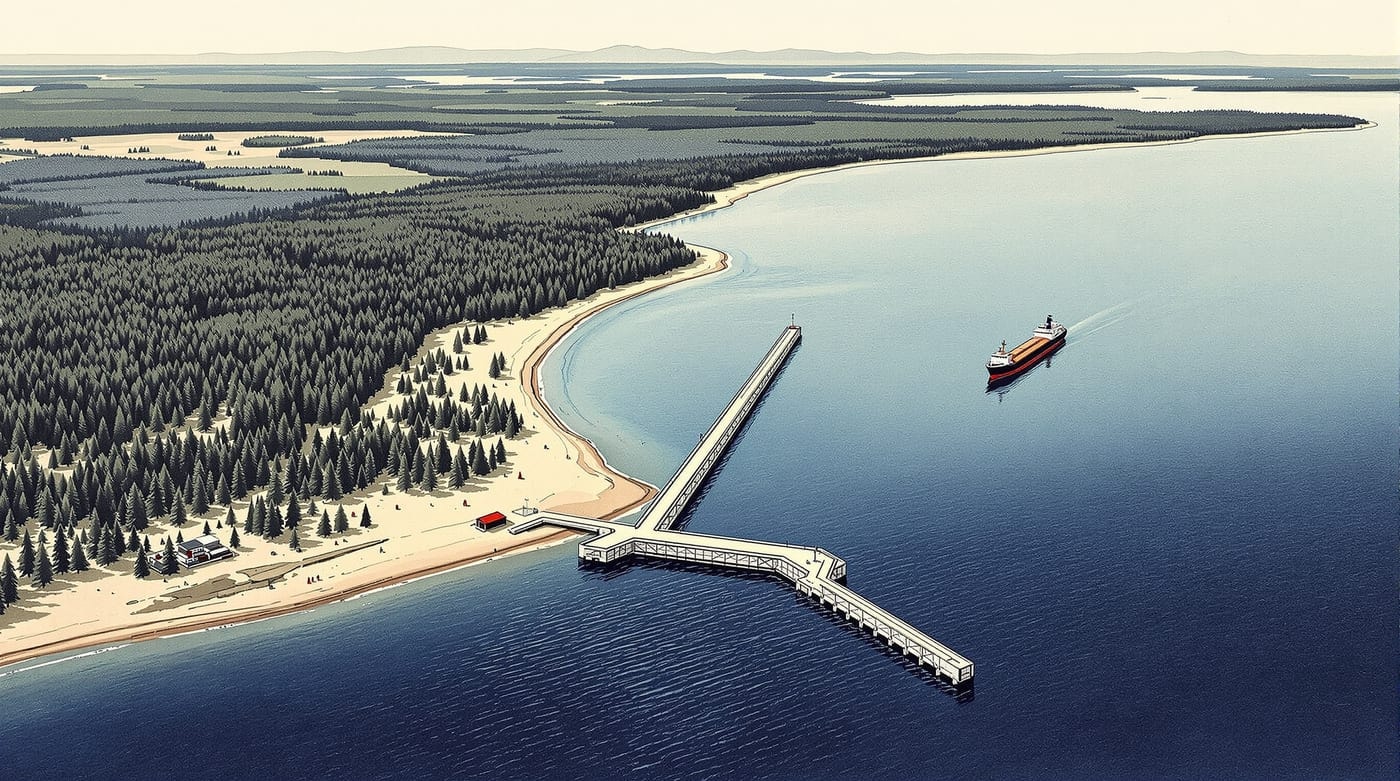
A shortcut is only worth having if you can find it. The approach from Keweenaw Bay is the hard end: the shore is low, thickly and uniformly forested, and offers a helmsman almost nothing distinctive to take a bearing on. In haze, in snow, or at night, one stretch of that coast looks precisely like the next — and the entrance itself is a narrow gap in an otherwise continuous shoreline.
That is the specific navigational problem the light was built to solve, and it explains the station's position: set a short distance from the river mouth, high enough and far enough back to be picked up on the approach rather than only once a vessel was already committed.
Why the light was superseded
Through the second half of the nineteenth century the waterway was progressively enlarged and improved for bigger vessels, and long breakwater piers were carried out into the bay to hold a dredged channel open against drifting sand.
Those piers changed the geometry completely. The functional entrance was no longer at the shoreline but at the outer end of the breakwater, some distance out into the bay — and a light standing back on the beach was now marking the wrong point. On 1 August 1920 a major light was established on an octagonal steel structure at the pier end, and the old station was discontinued. It is a common pattern across the Great Lakes: shore stations superseded not by better lights but by harbour works that moved the water beneath them.
The country around
The station sits on the west shore of Keweenaw Bay, the large body of water on the south-east flank of the peninsula, with the low blue line of the Huron Mountains visible across it in clear weather. Inland the country is boreal forest — pine, birch, aspen — over the sandstone and conglomerate that made the district's fortune.
Two industries shaped this shoreline. The first was copper: the Keweenaw carried one of the richest native copper deposits ever worked, and the mines, mills and ports built around it are the reason there was any traffic to guide. The second was building stone, quarried a short distance from the light and shipped out by lake — the subject of Jacobsville sandstone. Both stories are held by Keweenaw National Historical Park, and by Michigan Technological University, founded in 1885 to train mining engineers for this district.
Seasons
Navigation here has always been seasonal. Ice closes the lake to commercial traffic through the deep winter, and the shipping season opens and closes around it — which is why the station's fuel had to be stocked in advance, and why a keeper's year had a rhythm quite unlike a coastal lightkeeper's on an ice-free coast. The former owners noted that late autumn, from October into December, was the best time to watch ships working the bay: the season's last movements, in its worst weather.
Nothing on this page is intended for navigation. Current charts and notices are published by the relevant federal authorities; nothing here should be relied upon on the water.